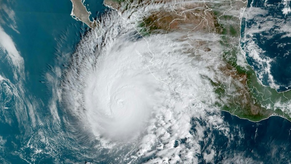
Hurricane Norma strengthened Thursday to a powerful Category 4 storm as it headed toward Mexico's Pacific coast with maximum sustained winds exceeding 209 kilometres per hour, the US National Hurricane Center (NHC) said.
"Norma is a Category 4 hurricane on the Saffir-Simpson Hurricane Wind Scale," said the center, which grades such storms up to a maximum Category 5.
Maximum sustained winds were near 215 kilometers per hour, with higher gusts.
"Small intensity fluctuations are possible today, followed by gradual weakening beginning Friday and continuing into the weekend," said an NHC statement.
Norma was moving northward at about 11 kilometers per hour, and was expected to approach the Baja California peninsula on Friday night and Saturday, with tropical storm conditions possible by early Saturday.
"Norma is expected to produce rainfall totals of 5 to 10 inches with local (maximums)... of 15 inches through Sunday across the far southern portion of the Mexican state of Baja California Sur," said the statement.
"These rains will likely produce flash and urban flooding, along with possible mudslides in areas of higher terrain."
At 12H00 GMT, the epicenter was 410 kilometers west of Manzanillo, in the western Mexican state of Colima.
- Soldiers on alert -
The government on Thursday activated a national emergency plan, placing more than 6,600 soldiers on alert, according to the defense secretariat.
Just last week, western Mexico was hit by Hurricane Lidia, which left at least two dead after making landfall as a Category 4 storm, causing flooding.
Days earlier, Tropical Storm Max left two people dead and dozens of houses flooded in the southern state of Guerrero, one of the country's poorest regions, authorities said Tuesday.
Hurricanes hit Mexico every year on both its Pacific and Atlantic coasts, usually between May and November.
Scientists have warned that storms are becoming more powerful as the world gets warmer with climate change.

