JOHANNESBURG - Parts of the country continue to be battered by extreme weather conditions.
The South African Weather Service (SAWS) has issued a warning for disruptive rainfall between 5 and 7 May 2026.
According to the weather service, an intense cut-off low-pressure system is expected to result in scattered widespread showers and rain over the eastern parts of the Western Cape from Wednesday into Thursday.
On the other hand, a Yellow Level 2 warning for disruptive rainfall is expected for the central interior of the Western Cape as well as the Karoo Hoogland of the Northern Cape.
READ | 'Weather could disrupt N2 and N3' - KZN Cogta as province brace for heavy rainfall
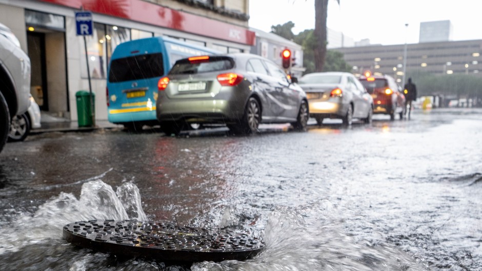
SAWS forecaster Lehlohonolo Thobela said disruptive rain that will result in measured amounts of between 100 and 200 mm of water depth, which may lead to localised to widespread flooding.
This, he said, will persist along the south coast of the country into the adjacent interior, impacting the Garden Route into the western half of the Eastern Cape.
This level of rainfall means a large volume of water falling in a short time.
That water falls directly onto the ground and is not absorbed fast enough.
In some areas, it can build up to just above ankle height.
READ |Two dead in Northern Cape as heavy rains cause havoc
Thobela said this is not just light rain, and it can have major impacts on roads being cut off, communities evacuated from low-lying areas, as well as cause disruptions on the roads and increase traffic, resulting in gridlocked routes, and may also cause sink holes.
As such, Thobela has cautioned residents to be vigilant when traveling and keep headlights on if they will be driving in reduced visibility areas due to heavy rain.
If at all possible, residents are advised to travel during these times, he said.